GeoSetter 2.4.3.527

Free showing & changing geo data of image files
4.7 
Rating
Your vote:
Latest version:
3.5.3 See all
Developer:
Friedemann Schmidt
Screenshots
1 / 14
Awards (8)
Show all awards
Software Informer Editor Rating 4
Download
Free  

Features
Reads and writes the formats JPEG and TIFF as well as camera RAW formats DNG (Adobe), CRW and CR2 (Canon), NEF (Nikon), MRW (Konica Minolta), PEF (Pentax), ORF (Olympus) and RAF (Fujifilm)
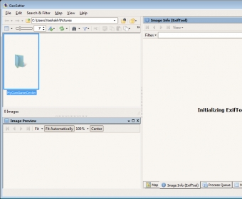
Uses ExifTool from Phil Harvey for writing data
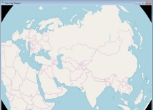
Shows existing geo coordinates and tracks on embedded Google Maps map (requires internet connection)
Setting geo data by using embedded Google Maps map (requires internet connection) or by entering known values for coordinates and altitude directly
Automatic filling of location IPTC fields and altitude values (requires internet connection)
Editable IPTC data (IPTC-NAA/XMP)
Possibilty to change taken date of images
Synchronization with track files (NMEA, GPX, PLT and Sony LOG)
Synchronization with already geo tagged images with buddy images (e.g. between RAW images and their corresponding JPEG images)
Localizable user interface - English, German, French, Italian, Swedish, Czech, Spanish, Danish, Dutch and Russian language is available at the moment

Comments (4)

4.7
Rating
23 votes
5 stars
20
4 stars
1
3 stars
0
2 stars
2
1 stars
0
User

Your vote:

F
rating Flo Vap
Best EXIF editing tool ever.

Aug 11, 2023 Was it helpful?  yes(0) no(0) | Reply
S
rating Susan
I've been using it for years and it's the best

Jul 14, 2021 Was it helpful?  yes(0) no(0) | Reply
F
rating Frank Lichte
Great utilty to manually geotag images.

Was it helpful?  yes(2) no(0) | Reply

Related software

GEO Spider
GEO Spider
rating

It can analyze and trace all network applications on the fly

Image Metadata Manager
Free
rating

See and change the metadata information of your pictures or photos with ease.

Adept PDF Info Changer
Free
rating

Read and change the PDF file properties / metadata information.

Geo-Tag Mapper
Geo-Tag Mapper
Free
rating

Plot geotagged images in a selected folder on a virtual globe

Ingestamatic
Ingestamatic
rating

You can look at a preview to decide which photos you want to ingest.

Related suggestions

Tags

Geo tag Image location Photo location Location tag Image tag Edit metadata Photo tag Image metadata Change date English language